Tourist Plaques
This is a home page for all the proposed tourist plaques that may be added to buildings in Tewkesbury.
Abbey Lawn Cottages
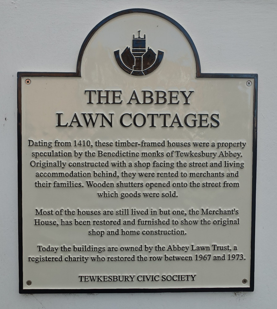
Click Image to Expand
Arthur W. Stevens
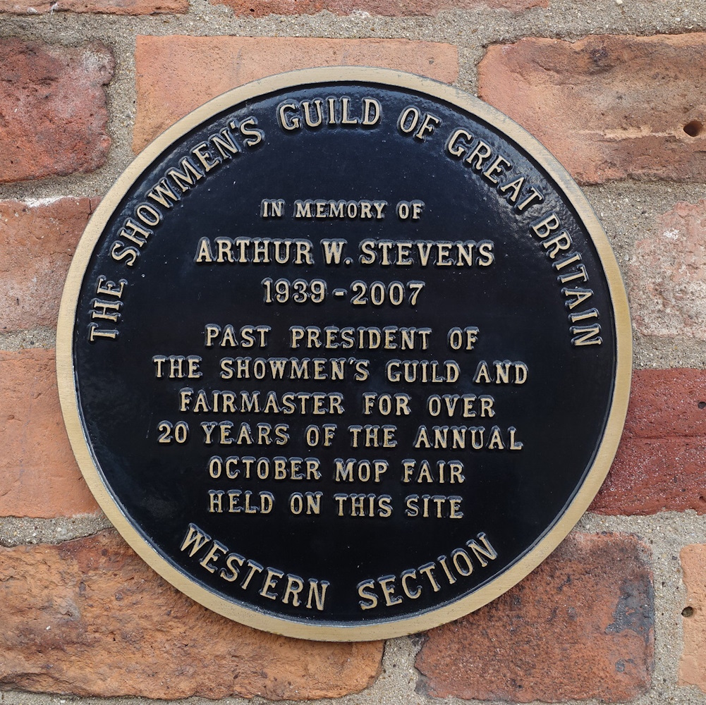
Click Image to Expand
Bishops Walk Plaque - including 90 High Street and the Doddo Restaurant
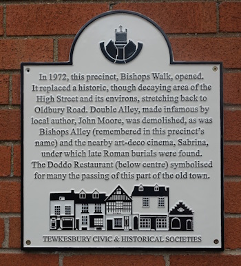
History of the Upper High Street Shopping Centre. This plaque was a joint venture by THS and The Tewkesbury Civic Society, unveiled in 2024 opposite Tesco exit on the wall of Sue Ryder.
A book on the subject, Doddo Defiled, was published in 2004 by John Dixon and Toby Clempson, a digital copy of the book can be read here.
In 2017 the book was simplified and updated in Tewkesbury Then and Now Volume V which can be read here. Sam Eedle designed a map, which superimposes the modern development with a historical 1883 map. We have also provided, in February 2024, a table of addresses of Historical Tewkesbury compared with 2024. From there, you can read about the history of each property.
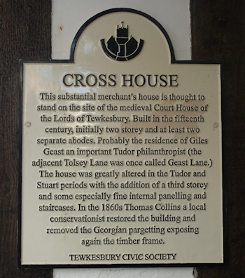
Cross House
Fair Society

Click Image to Expand
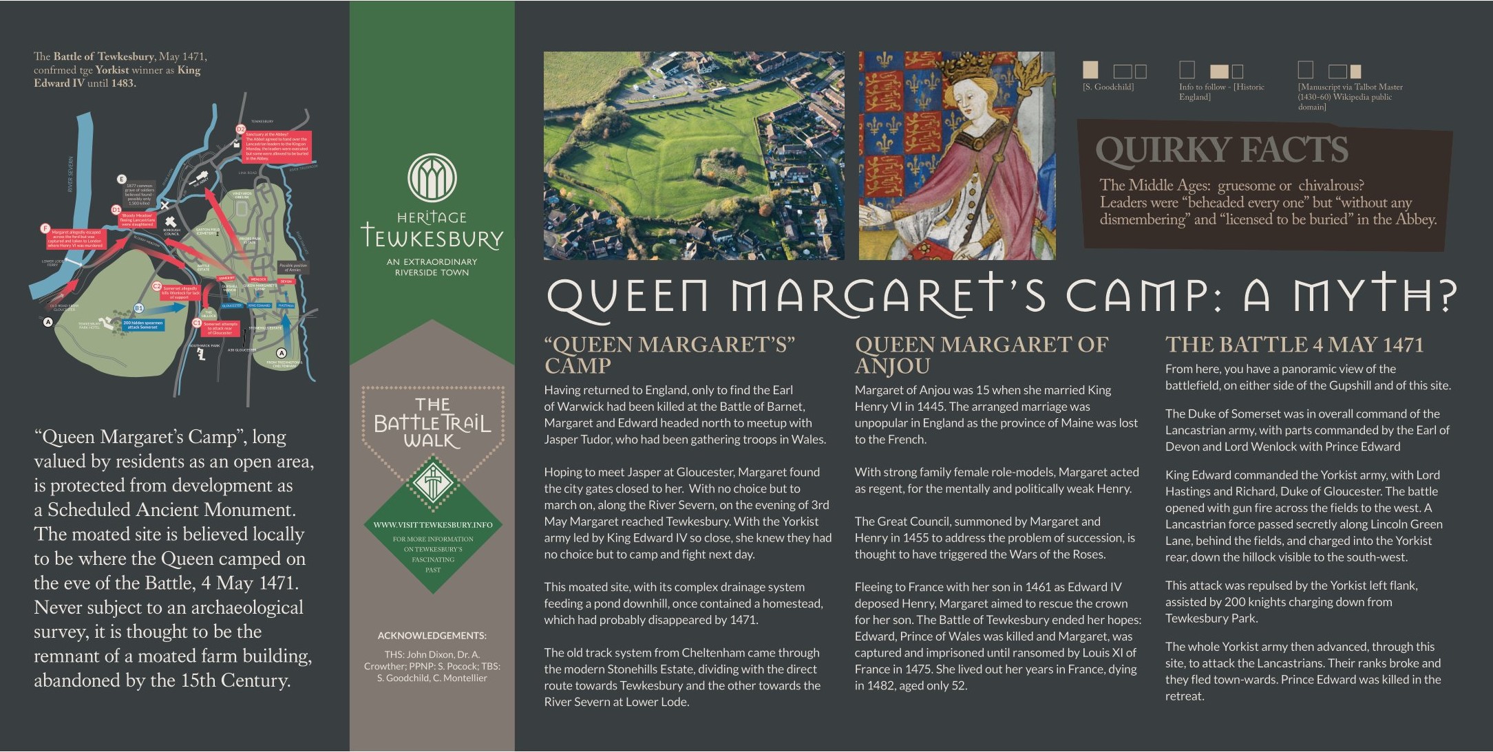
Queen Margaret's Camp
Tourist PlaqueClick Image
to Expand
to Expand
This sign was inspired by the 'Glorious Childhood in Prior’s Park' of members of the History Research Group of Prior’s Park Neighbourhood Project.
The Project Co-ordinator is James Baker, and the History Advisor is John Dixon, President of Tewkesbury Historical Society, aided by its designer Rick Talbot. The members of the group, which meets monthly at PPNP, are Steve Pocock, Edward Jones, Anne Ludlow [née Dawe], Avril Taylor [née Avery], John Blencowe and Rob Brett.
We had the support of Cllr. Cate Cody and were financed by Georgia Smith and the High Street Action Project who will formally unveil the sign.
The HSAZ designers had little space for all the ideal information which can be read on Queen Margaret’s Camp: A Myth?
For this, we were assisted by Steve Goodchild and Clive Montellier of the Battlefield Society and Dr. Andrew Crowther of THS.
When the estate was started in 1919, it was called Prior’s Ground [after a rich hosier] and it was conceived as a village with streets with geographical names. Named Priors Park in 1926, the number of streets increased but it was after WWII that Perry Hill was inhabited by a great number of residential streets – and it was decided to name them after aspects of the 1471 Battle of Tewkesbury – so if you would like to know who inspired the name of your Street click here.
We hope that this sign will increase the interest of both tourists and residents in their own estate on a par with the Riverside Walk Scheme in the centre of the town.
For more information see https://priorsparkneighbourhoodproject.co.uk/
John Dixon presidentths@gmail.com
James Baker James.Baker@ccp.org.uk
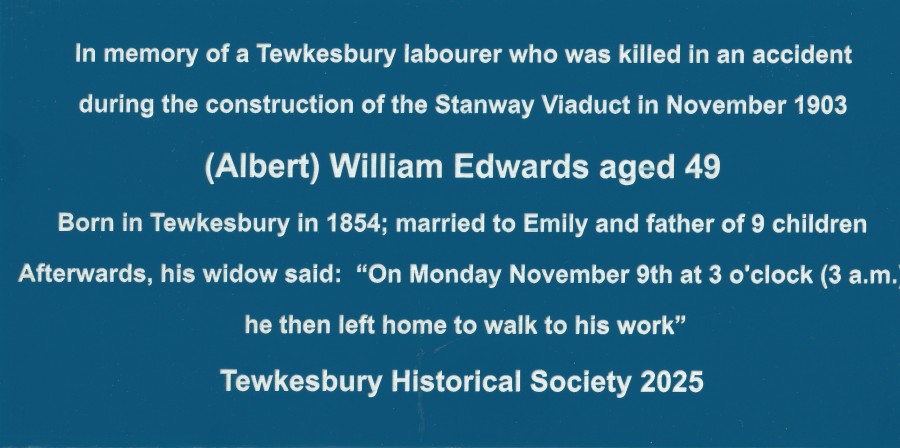
Stanway Viaduct Disaster, 1903
Click Image to Expand
THS Investment in a Plaque at GWSR Stanway Viaduct To Commemorate Loss of Life of Tewkesbury Labourer
The Gloucestershire Warwickshire Steam Railway has appealed for financial support to restore this viaduct at an estimated cost of £1.5m. THS became interested when it discovered that one of the four men who lost their lives in the disaster was a Tewkesbury Labourer. We feel that his life should be commemorated.
THS, therefore, bought this plaque from GWSR at a cost of £250.00 to commemorate the Death of a Tewkesbury Worker.
Read on for the Full History of Tewkesbury’s Tragic Victim.
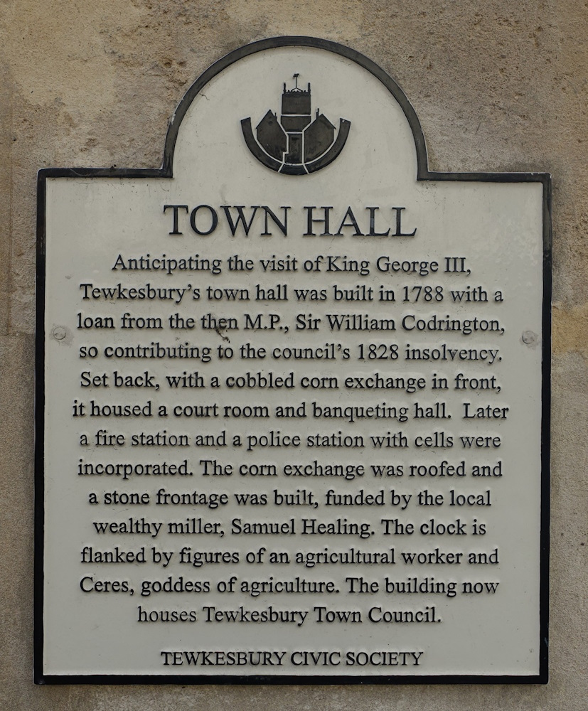
Tewkesbury Town Hall
Click Image to Expand
Click on 'Read More' to read John Dixon's article on the History of the Town Hall published in THS Bulletin 30 in 2021.
Tewkesbury's First - and Forgotten Railway Station
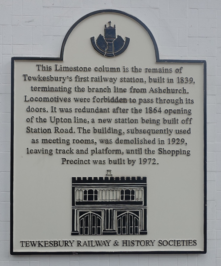
Click Image to Expand
Tewkesbury Civic Society
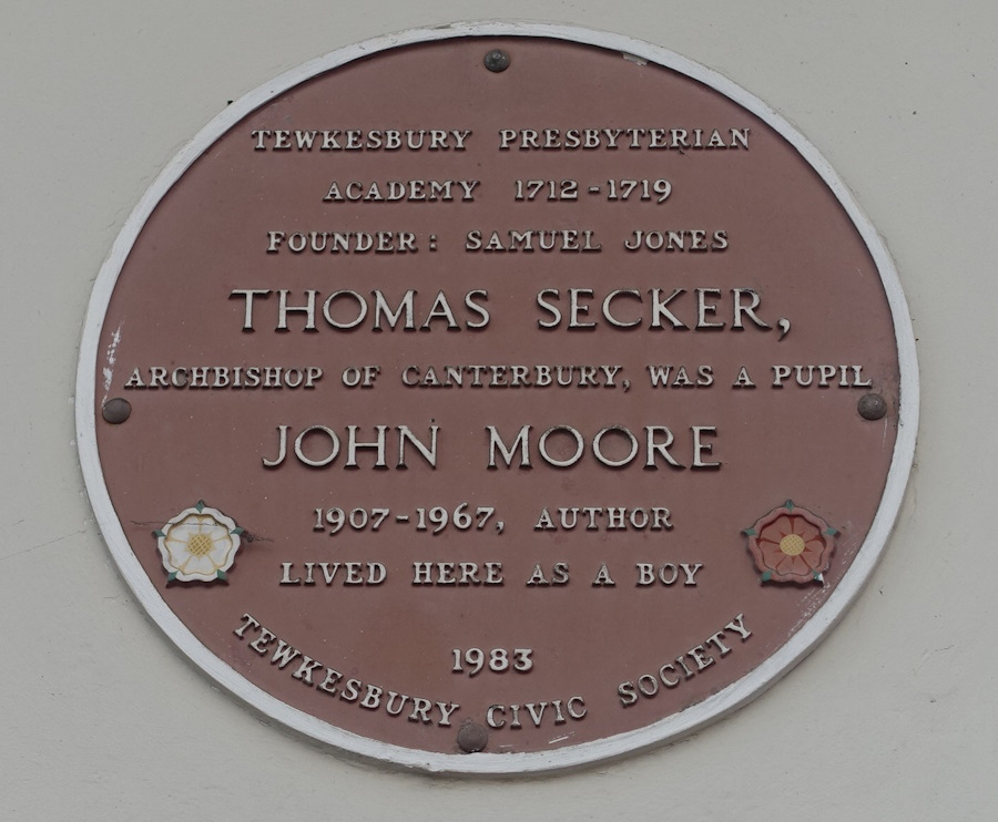
Click Image to Expand