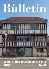
Some Glimpses Of Tewkesbury In 1540
On 12 January 1540 the keys of the Abbey of Tewkesbury were passed over to Robert Southwell, or another of King Henry VIII's commissioners, and the last monks departed from the buildings. Soon builders would arrive with ladders and start stripping the lead from the roofs and demolishing all the conventual buildings which had been intrinsic to the life of the monastery: the dormitory, the refectory, the cloister. People from the town and from much further afield would come to scavenge for building materials, a load of stone, some tiles, or even just one stone, perhaps as a superstitious symbol of holiness for their houses. The abbey church itself would not be demolished, because negotiations were proceeding with the king, which after two years resulted in the townsmen buying the building for £483.[1] Books from the library, gold and silver chalices, embroidered robes and other costly items were packed and dispatched to one of the king's treasure houses. The site of the monastery was not quite deserted, however, as a few pensioners and other laymen still occupied their rooms and were left undisturbed, except for the general din and confusion that no doubt lasted for months. The abbot's house, too, was probably occupied by servants, if not by the new leaseholder himself.
The great estate of the abbey was also in process of being broken up, and lawyers were busy drafting leases for potential purchasers, who after a few years were often able to buy their estates outright. Meantime, bailiffs administered the abbey's estate, and had to prepare accounts itemising all the rents due and received, and fees paid, at the end of the first year. Many sheets of parchment were required to itemise the abbey's possessions, in Latin, and this vast document is in the Gloucestershire Record Office (P329/Ml/l and 5).[2]
The court style of handwriting is difficult, but a typed transcript exists and has been used for this article. As a result of describing the document to those attending evening meetings on the history of Tewkesbury in the autumn of 1992, Colin Wicken and David Bevans both undertook translation and summary of large sections. and their work is gratefully acknowledged. In this article, some of the insights into the town provided by the dissolved monastery's rent roll are described. It is hoped to present a more detailed analysis of the householders in a future issue of the Bulletin, and to describe the surrounding areas of The Park, Southwick and the Mythe.
The account begins:
County of Gloucester
Former monastery of Tewkesbury
Manor and town of Tewkesbury with the site of the former monastery there
The account of Daniel Perte bailiff of the Lord King there viz. from the Feast of St Michael the Archangel in the 31st. year of the reign of King Henry VIII to the next following Feast of St Michael the Archangel in the 32nd year of the reign of the said Lord King i.e. for one complete year.
Arrears: None, because this is the first account of this accountant. There were arrears the following year, because altogether £4.2s.7d. (£4.0s.12½d) could not be collected.
In the accounts dates are normally presented in full; the Annunciation of the Blessed Virgin Mary (Lady Day, 25th. March) and the Feast of St. Michael the Archangel (Michaelmas, 29th. September) were the two Quarter Days most often specified, but the Feast of the Birth of Our Lord, and of St. John the Baptist (24th. June) were sometimes relevant. The year was indicated by reference to the length of the king's reign, and has to be calculated from the exact date of accession. These accounts relate to 1539 to 1540. The Abbey was not closed until January 1540, so that payments made on Lady Day 1540 partly related to the last months of the Abbey's existence.
The owners of the first fifty properties itemised in Daniel Perte's accounts (pages A to E in the transcript) had paid fixed rents, or 'assisted rents', to the abbey as lord of the manor. Payments varied from as little as four old pence (2p) to 103 shillings (£5.15). The names of both the owner and the occupier of the property were stated and often also the occupier's trade. There were several tailors, shoemakers, tanners, butchers, one goldsmith (on the east side of High Street), a waxmaker and a saddler. Did the 'sapper' make. soap, and the 'harper' make harps?
The next group (pages E to J in transcript) comprised 48 'customary' tenants of the former abbey. Each house, garden or stable was held by 'copy of court roll'. It was usual for a manor court to he held at least once a year and the tenants of the manor were all supposed to attend; land was transferred in the court from one tenant to another, following either a death or the sale of a property, so that the manor court acted as a land registry. A record was made on parchment of the name or names of the new tenants, the size of the holding and any payments or obligations due from the new holder. A copy of this court roll provided a deed of entitlement. Both individual 'copies' and the manor court rolls were therefore carefully preserved and many still exist. Each manor had its own 'customs' or local peculiarities. In Tewkesbury, it appears that three people were normally joint holders of a tenement - often a man, his wife and his son. When one 'life' died, the others remained in possession and undisturbed. New 'lives' could be substituted by application to the manor court. Rents were small but a lump sum was paid when a new copy was made. Copyholds are sources of interesting family history. For instance, a customary rent of 12s. (60p) was recorded for a tenement or holding and a garden at the north end of the town 'in the tenure of Richard Pulton by copy of court holding to himself, Elizabeth his wife and Anthony, Constance, Thomas, Alice and Richard their children.' Another customary rent of 16,s. (80p) was paid for a tenement on the other side of High Street by 'Alexander Pury in place of Margaret formerly wife. of Thomas Alye and before him wife of Andrew White also called Andrew Tayllor.'
It is surprising to find copyhold premises scattered throughout Tewkesbury's streets, When a new market town was laid out, the 'burgages' or town plots were freehold. Copyhold was usually associated with agricultural villages. It might be that the copyhold plots and houses predate the founding of the market town; for example, the group of properties including Richard Pulton's described as 'towards the water of Avon between the north end of the said town and le Keylane' might have been beyond King John's Bridge, and have existed before High Street was laid out. Alternatively, allowance might have been made for a mixed population of labourers and more prosperous burgesses in the planning of the town. Is the unusual proportion of labourers in Tewkesbury in the early seventeenth century to be traced back to these copyholds?
Copyholders in Tewkesbury in 1540
| East side of Church Street backing on to the former monastery | 6 |
| Between the Bull Ring and the Cross | 7 |
| Church Street backing onto the Avon Mill | 3 |
| Street Walkers Lane (or St Mary's Street) | 5 |
| Barton Street backing onto the Swilgate | 4 |
| Barton Street backing onto the Oldbury | 4 |
| High Street backing onto the Oldbury | 6 |
| High Street west side at the top | 2 |
| High Street below Key Lane | 3 |
| Total | 41 |
Behind one High Street house on the Oldbury side there was a dovecot in the garden, in Key Lane there was a horsemill, one plot was described as a half-burgage, and there were also some copyhold gardens stables not included in the table above. There is a noticeable concentration of copyholds in the southern end of the town near the Abbey, where the tangle of lanes suggests unplanned early settlement. The houses in Barton Street may also once have been agricultural cottage plots, brought into the general town plan in the eleventh or twelfth centuries. The abbey's 'barton' or farmyard and barns were here. It is less surprising to find later in the rent roll (pages 126-129) 12 plots of land in the Odbury field which were copyhold, as this was certainly part of the older agricultural structure of Tewkesbury manor. The Oldbury field was divided into four sections or 'furlongs'; Netherfurlong, Middlefurlong, Overfurlong and Holeham furlong. The same divisions existed in 1811, before the field was developed, except that the furlong nearest High Street had become 'Upper' instead of Over' and 'Nether' had become 'Lower'.[3] There was very little copyhold in Holeham furlong; in 1540, Nether furlong was mainly pasture, but Middle and Over furlongs contained a good proportion of arable, suggesting a three-year crop rotation. The furlongs were obviously divided into narrow ridges of land separated by furrows, because some of the land holdings were described as 'selions', a word derived from the old French for 'furrow.'
After the town copyholds, Daniel Perte's accounts next list (pages K to S and 1-3 in the transcript) 172 tenants 'at the will of the lord.' In these cases an annual rent was paid and there was no written document, though custom often governed the terms and conditions. There were some small rents of a few pence for gardens or stables, while houses ranged from 4s. (20p) up to 33s. 3d. (165p) paid by Nicholas Riddesdale for a half-burgage and small garden. Eighteen properties were in High Street, 32 in Barton Street and 120 at the south end of the town, in Church Street and the lanes and alleys. First amongst the Church Street properties were 29 houses backing onto the monastery wall, of which nearly all survive in the restored Abbey cottages. The majority owed 8s. (40p) in rent and there was one rent of 16s. (80p) for a larger property. Two pieces of meadow, one at Homebridge and 'Hammocks' between Homebridge and the Avon, were also 'at. the will of the Lord.' Some of the properties were not houses; there were a number of gardens, two pig houses in Gander Lane, a stable in Long Alley, a large 'ruinous' building below Crisp Lane on the Avon side of Church Street, two shops towards Mill Street, and a vacant plot, 'formerly built on', in Barton Street on the Swilgate side. Some properties were single rooms. John Croxton paid 6s.8d. (34p) for a schoolroom over the Workhey Gate, the main entrance to the monastery; he had been a 'chaplain' in Tewkesbury in 1522[4], but either died or retired in 1540, as three-quarters of his rent was not collected. John Shirwood, clerk, had two rooms in the same place; in 1522 he had been curate of Boddington, but in 1540 was curate in charge of Tredington church. Another cleric, Roger Jenkins, had a room near the cemetery stile. The curate in charge of Tewkesbury parish was Richard Drake; the abbey itself had been the rector of Tewkesbury. Richard Drake occupied one of the larger Abbey Cottages. Both Shirwood and Drake had their rents remitted by the King, as did the twelve 'hedesmen' who prayed for him, who all lived in the southern end of the town.
Daniel Perte accounted next for the properties which were leased. These were generally larger and more important houses which had been owned by the abbey. First came the site of the abbey itself, or so much as had been allowed to remain standing, leased to William Rede Esq. of Mitton in Worcestershire, for 21 years, The rent of £14.16s. was of quite a different order to that for all previous properties. This section of the accounts contains so much of interest that it is quoted in full.
Farm
And he accounts for £14.16.0, of rent for the site of the said former monastery of Tewkesbury together with all houses, buildings, barns, stables, yards, orchards, gardens, ponds, fisheries, lands and (?) soil within the site and precinct of the said former Monastery formerly in hand and occupied by the said Prior formerly by the Abbot at the time of the dissolution of that monastery.
And also the whole Grange called the Abbots Barton in Tewkesbury aforesaid with all houses, arable lands, meadows, pastures and rights of pasture belonging to the same Grange lying and being in the fields called Garston le Hill Southwikesfyld and Le Pury de le Hill Wynyard Swylyat Medow Severne Ham Dolemede Almondshill and Kyngesmede in Tewkesbury aforesaid in the said county of Gloucester formerly belonging to the said monastery which was reserved in. the hand and occupation of the said former Abbot at the time of the dissolution of the said former monastery. And all the fisheries and fowl traps in and over the separate waters called the Old Avon in the parish of Tewkesbury aforesaid near the Key of the said town as far as a certain other stage, and from a certain stage on the River of the Severn called the mouth of Old Avon aforesaid near the town Key aforesaid as far as a certain other stage called the Stanchard. And all the fisheries and font/ traps in creeks, gullies, ditches and ponds from the aforesaid Stanchard on the north and east sides towards the great River of the Avon aforesaid with all the commodities and freedoms of the said fisheries and fowl traps belonging to them. And also one parcel of land or pasture lying between the said Key on the west side of the water of Old Avon aforesaid and the Floodgate called Little Hammocks, which certain parcel of land was reserved and occupied by the said former Abbot. Excepting always that all great trees and woods growing and being on the premises were reserved to the Lord King, his heirs and successors. And [excepting] all such buildings within the site of the said former monastery which the said Lord King commanded to be thrown down and removed thus by Indenture given under the seal of the Court of Augmentations and Reversions to the crown of the Lord King 12 June in the 32nd. year of the reign of the same Lord King Henry VIII [1540] demised amongst others to William Rede of Mitton in the county of Worcestershire, squire, to have and to hold to the same William and his assigns from Michaelmas next for 21 years paying yearly 26s 8d. to the said Lord King, his heirs and successors viz. for the said site of the former monastery and other premises existing within the same site.
And for the aforesaid Grange called Abbots Barton with lands, meadows, pastures and rights of pasture belonging to the same £12.2s.8d. and for the aforesaid fisheries and fowl traps in the said parcel of land or pasture between the Key and floodgates aforesaid 26s 8d payable at the feast of the Blessed Virgin Mary and Michaelmas equally as is contained in the same indenture; this year being the first.
The heading 'Farm' is the translation of the Latin 'firma', and described rent paid on leases. Because so much land was rented by the cultivators, 'farm' has come to describe cultivated land, and 'farmer' the husbandman or cultivator. The document recording the terms of a lease was called an 'Indenture', and the property was said to be 'demised' to the tenant. In describing the site of the Monastery, reference is made to the Prior. He was the administrative head of the organisation, whereas the Abbot was the titular head, and a much more important figure nationally. The difference can be indicated by the fact that the Abbot sat in the House of Lords and was given a pension of £266.13s.4d. when the abbey was dissolved, while the Prior was given ±16.[5] The Abbot's house and gateway were two parts of the monastery which were not destroyed. The lease to William Rede also dealt with the monastic farm of Abbot's Barton, which was termed a 'Grange'. The word often described a monastic farm which was enclosed, that is separate from the open-field agriculture of the area. The lands belonging to the Grange are named, and the field-names can still be located in Tewkesbury. The abbey had also farmed the fisheries in the River Avon, but the Swilgate fishponds in Vineyard Park are not mentioned.
The description of the fisheries and of Little Hammocks in William Rede's lease raises several interesting topographical points. 'Hammocks' seems to mean 'Little Ham', that is, a little water meadow. 'Hammocks' was also the name of a small close of land at the south end of Tewkesbury near the Abbey, between 'Homebridge' and the Avon. held by a tenant—at—will called William Wyatt. The abbot had kept Little Hammocks, which was near the Quay, in hand. In 1824, when the Abbey House Estate was sold, a map accompanied the sale particulars, the first one for Tewkesbury which identifies field names; the well known Croome map of the whole parish is dated 1825.[6] The Abbey House, once the abbot's house, and now the Vicarage, the Abbey Gatehouse, the Gaston field, and all the other lands named in the lease of 1540 still formed one estate. A meadow between the Mill Avon, the Swilgate and the Gloucester road was known in 1824 not as 'Hammocks' but as 'Wyatt's Mead', probably recalling the tenant of 1540. The Abbey House estate lay mainly to the south of Tewkesbury, but two little pieces of land called Upper and Lower Hammocks were near the Quay. Both together were probably the Little Hammocks of 1540; the abbot perhaps kept the meadow in hand because it provided him with a landing stage, so saving him the tolls paid for use of the town Quay, William Rede's lease mentions a Floodgate. It seems to have been the harrier to the Avon water above the Stanchard pit. In 1638 Hammocks was divided by the construction of a lock which allowed direct navigation between Severn and Avon. The lock—keeper's house and other buildings have now been erected on Little Hammocks. The Abbey officials distinguished the Avon waters quite precisely. The Mill Avon between the Key bridge and the Swilgate junction was called simply the 'Avon'; above the Key bridge both arms of the river were called the 'Old Avon', and the Quay was accurately placed on the western arm of the Old Avon.
Twenty-six other properties in Tewkesbury were held under leases which had been granted by the Abbot and 'Convent' - the community of monks. Two were single rooms in the Cemetery, and two more single rooms were next to the Belfry. The Great Hospice (an hotel rather than an hospital) called The Crown or The New Inn in Church Street was leased to John and Alice Pers for 60s (£3). The lease obliged them to attend the abbey's Barton Manor 'court baron'. A court baron usually met every three weeks to deal with the transfers of copyhold land, and the maintenance of the Customs of the Manor, particularly with regard to farming practice. This suggests that the Crown Inn had been part of the original agricultural manor of Tewkesbury. The lessees of the Crown Inn were guaranteed access to the Swilgate, perhaps placing the inn in the Berkeley Arms. John Peers, his wife Alice and three children, John, Edward and Elizabeth, also leased gardens, dovecots, a granary and hams in Barton Street. Near the Bull Ring, John Tommes and his wife, Christiana, leased a mill, but the rent roll does not say whether it was worked by the water of the Swilgate. Another leasehold property was a cow house situated in St. Mary Street.
Amongst the leasehold properties were five burgages or fractions of burgages. It was quite normal for the original burgage plots to have been subdivided, frequently into four, and houses built on each part. This is the reason for the very long, thin plots characteristic of Tewkesbury and of other towns, too. An interesting lease is that for a property in High Street on the Oldbury side.
And for 8d of rent for another half burgage and garden and appurtenances in the said vicinity demised to Robert Payne, Katherine his wife, Agnes and Elizabeth their daughters by indentures for forty years if they live so long or if one of them lives so long payable at the Feast of the Annunciation of the Blessed Virgin Mary and the Feast of St Michael the Archangel equally. And the .said Robert, Katherine, Agnes and Elizabeth will repair, maintain and look after well and sufficiently all the houses and buildings of the half burgage and the garden fence and the pavement in the vicinity, whatever the work may be, during the said term as in the indenture between the said former Abbot and Convent and the same Robert, Katherine, Agnes and Elizabeth dated the 20th. day of July in the first year of the reign of King Henry VII [1486] of which this year is the 56th. Robert and Katherine are dead, but Agnes and Elizabeth are in vigorous life.
The requirement to maintain the pavement was general to leases, as also to repair the house, buildings and fences. In one respect, however, this lease was unique in being of such very long standing. The majority of the former abbey's leases had been made one or two years before the dissolution, in some sort of attempt to raise revenue before the closure, which was clearly anticipated, and also perhaps to reduce the amount of property which was going to be forfeited to the King. Inflation had made the rent of a half burgage rise forty-five-fold since 1486.
It is apparent that the abbey had controlled a very large amount of the town, but not the burgages which had always remained in the King's hands; in the early sixteenth century the King had 136 burgages, but according to the 1540 rent roll the abbey had seven.[7] Only burgage holders could choose the two town bailiffs, the two sergeants and the two constables. The abbey's rent roll reveals another 270 properties in the town. In 1575, the first royal charter for the borough of Tewkesbury from Queen Elizabeth I referred to 'the bailiffs, burgesses and commonalty' of the town, and from this time it seems that the distinction between original burgage plots and other properties in the town was lost, especially as burgage rents previously paid to the crown were extinguished by the charter.
The abbey rent roll thus shows that the street pattern of Tewkesbury was fully established by 1540, although the names of certain lanes were subsequently changed. In High Street, properties were located with reference to Red Lane and Key Lane on the west, but on the east Side there was apparently no prominent lane or alley to divide the street frontage. In Barton Street, properties were simply identified by reference to 'backing the Swilgate' or 'backing the Oldbury field'. Around Church Street, however, there were many lanes and one alley used for identification. Between Gander Lane and the cemetery stile, properties all backed onto the monastery wall. The 'stile' suggests that the way into the churchyard was narrow, and that Church Street did not then extend as far as separating the Bell from the abbey grounds. The Bull Ring and the High Cross further defined Church Street on the Swilgate side. A tollbooth, where market traders paid their tolls, was situated at the junction of the three main streets, where later the Tolsey was built. On the Avon side, there was Crisp Lane (was this later called Geast Lane alias Tolsey Lane or Post Office Lane?), Long Alley (probably the Old Baptist Chapel Court), Mill Street, Wayte Lane, Baek of Avon, Walkers Lane. part of which was also called St Mary's Lane or Street, and Brasicrs Lane. Several lanes have probably all become St Mary's Lane. The sixteenth century citizen of Tewkesbury who was able to return to the town in 1994 would find it quite easy to find his or her way round the town.
References
- James Bennett: The History Q/ Tewkesbury' (1830); pp. 123-6, 352
- Gloucestershire Record Office: P 329/M1// and 5
- Gloucestershire Record Office: Q/R//141
- 'The Military Survey of Gloucestershire' (1522), edited by R, W.HoyIe (BGAS. 1993)
- Bennett. ibid.
- Gloucestershire Record Office P329/l,V 3/1
- 'The Victoria History of the County of GIoucester' VI, edited by C.R.Elrington (1968) p. J 10
Comments