Maps
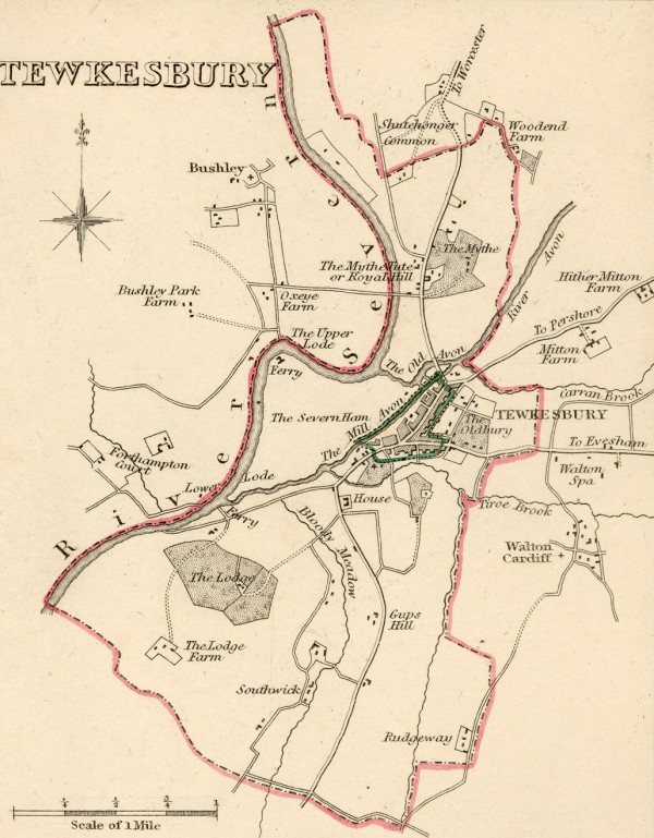
Tewkesbury 1835
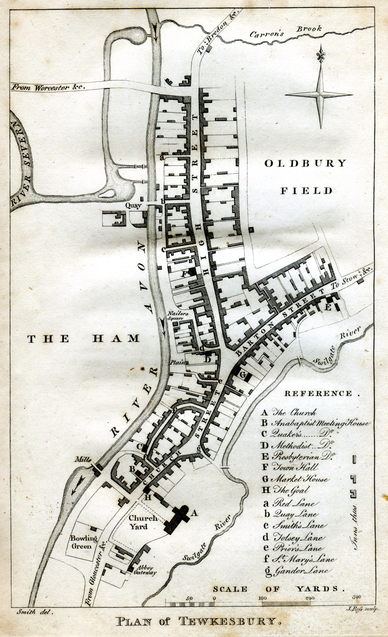
Williams Dyde's map published in The History and Antiquities of Tewkesbury, 1790
This is the first detailed map that exists before Ordnance Survey began mapping Britain.
Enclosures Map of 1811
This map from 1811, now in the County Records Office, shows the acreage owned by individuals on the Severn Ham and fields and meadows around Tewkesbury as part of the enclosures carried out at the time. Boundaries on the ground are marked by stones. most of which have now disappeared as there is only one owner, to all practical purposes, and the land is let for the grass in blocks of about 30 acres.Click to view.

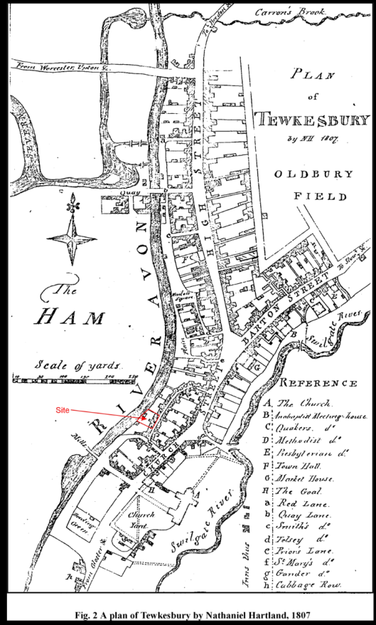
A Plan of Tewkesbury by Nathaniel Hartland, 1807
Plan of Tewkesbury by William Dyde, 1790
W Dyde's 1790 Map